Travelling The Friendship Highway

The Friendship Highway is an 800 km scenic route connecting Lhasa, the capital of Tibet, with Kathmandu, the capital of Nepal. It crosses three passes over 5,000 metres, but the route was closed after the devastating earthquake in Nepal during April and May 2015. This trip was made before Nepal became a republic and further restrictions were made on some nationals travelling to Tibet–or Xízàng as the Chinese call the province.

My first night in Tibet was spent in the border town of Nyalam, a small inconspicuous settlement at the edge of the Tibetan plateau–3,650 meters above sea level. It was supposed to be full moon night, with a clear sky and fresh, crisp air. Instead rain had fallen all night, and in the early morning hours clouds were hanging low and the mountain slopes were covered with a thin layer of snow. It was cold, even though it was in the middle of September. 

1_2002_Tibet_609-25jpg

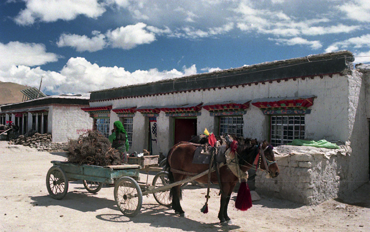
Sunday, September 22, 2002: On this first morning, when I got up at seven it was still pitch dark and raining. As I peeped through the door from Ngu Dahn–the small, but friendly guesthouse we stayed in–I saw only one street. I still heard the rain falling on the wet cobblestones, just as I had heard the rain all night. I had to get up to pee quite frequently during the night, as the Diamox that I took to counterattack a potential mountain sickness, had the pleasant side effect of forcing me to the loo a lot. Likewise, the oxygen level at 3,600 meters was low enough to produce heavy breathing as I climbed the stairs to the bedroom.
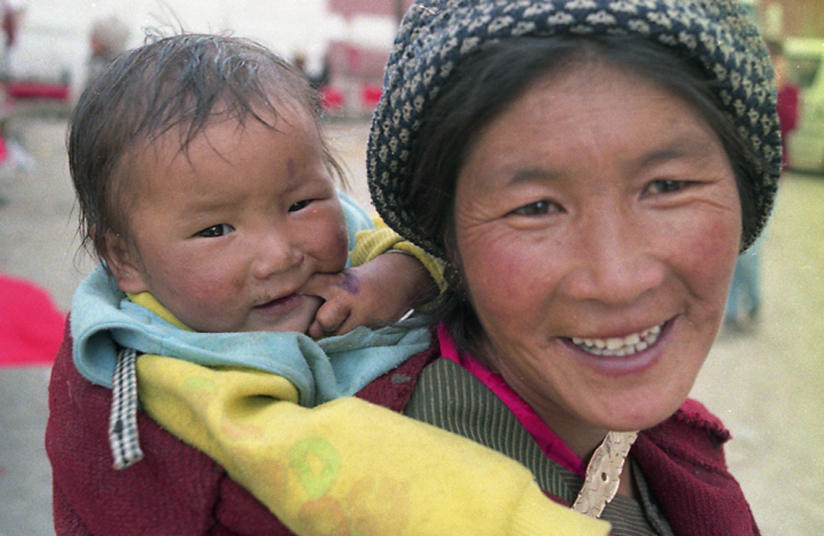
Dusk had already arrived as the 4WD pulled into the major square in the Tibetan border town of Nyalam the night before. A hoard of drunkards and begging children greeted my travelling company, as dozens of them surrounded the car even before the driver was able to park it properly. The rain had just started, I could feel the cold, and the darkness came upon us quicker than we were prepared for. Fortunately our hotel was only 20 meters across the square, but the muddy and slippery open place was difficult to negotiate in the dark with a dozen begging children clinging to your legs. The kids, younger than ten most of them, were clad in filthy rags, and they smelled.

Once inside the hotel we were placed six men to the room. One toilet for the whole entourage had to do, and there were no showers. Hot water was provided in a bottle, together with a small pot and half a dozen tea bags. At ten in the evening, while we were eating, I could feel the cold creeping in on me. It was probably only around ten-twelve degrees inside the restaurant.
As my first night in Tibet also happened to be my birthday, I splurged with fried pork and vegetable Chinese style, together with egg and tomato soup. All for less than 50 Yuan, which by Chinese standard was a bit expensive. The dining room was filled with westerners, as there were two caravans of travellers using the lodge. Three young girls were looking in from the outside, squeezing their curious faces towards the glass. They were dressed in traditional Tibetan fare, with scarves over their heads to keep the cold out.
The bedroom was even colder than the dining room, so I slept with my clothes on. With no running water I wasn’t able to wash, but managed to brush my teeth. I put my shoes, water and toilet paper next to my bed, so that I could find them in case I needed to get up to the toilet during the night, which I probably would. Went to bed first of all the guys, at 11 pm Chinese time.

We had left Kathmandu, the Nepalese capital, some 12 hours and 124 kilometres earlier that Saturday morning. A bus had brought my group of 21 foreigners towards the Chinese border at Kodari. It was a beautiful morning in Kathmandu when the bus left the Thamel area just as the sun was rising above the horizon. Soon outside of the urban areas, the road wound through rice paddies shining in the sun. Through the bus windows we could see the peaks of the Himalayan mountains towards the north, and the green hills on the southern side of the road.

The bus slowly made its way through the green landscape with orange painted mud houses making a stark contrast. Saturday morning was quiet, as Saturday is a holiday in Nepal. No children were making their way to school today, but housewives were struggling towards the market with potatoes, cauliflowers and onions. The bus passed one village after the other before making a stop at Dhulikel for breakfast.

Sitting at the top of a ridge, we enjoyed our morning coffee, eggs and bacon with a marvellous view of the Himalayan range. Far in the distance we could see the Everest, as this morning wasn’t cluttered in clouds, as was usually the norm in September. 


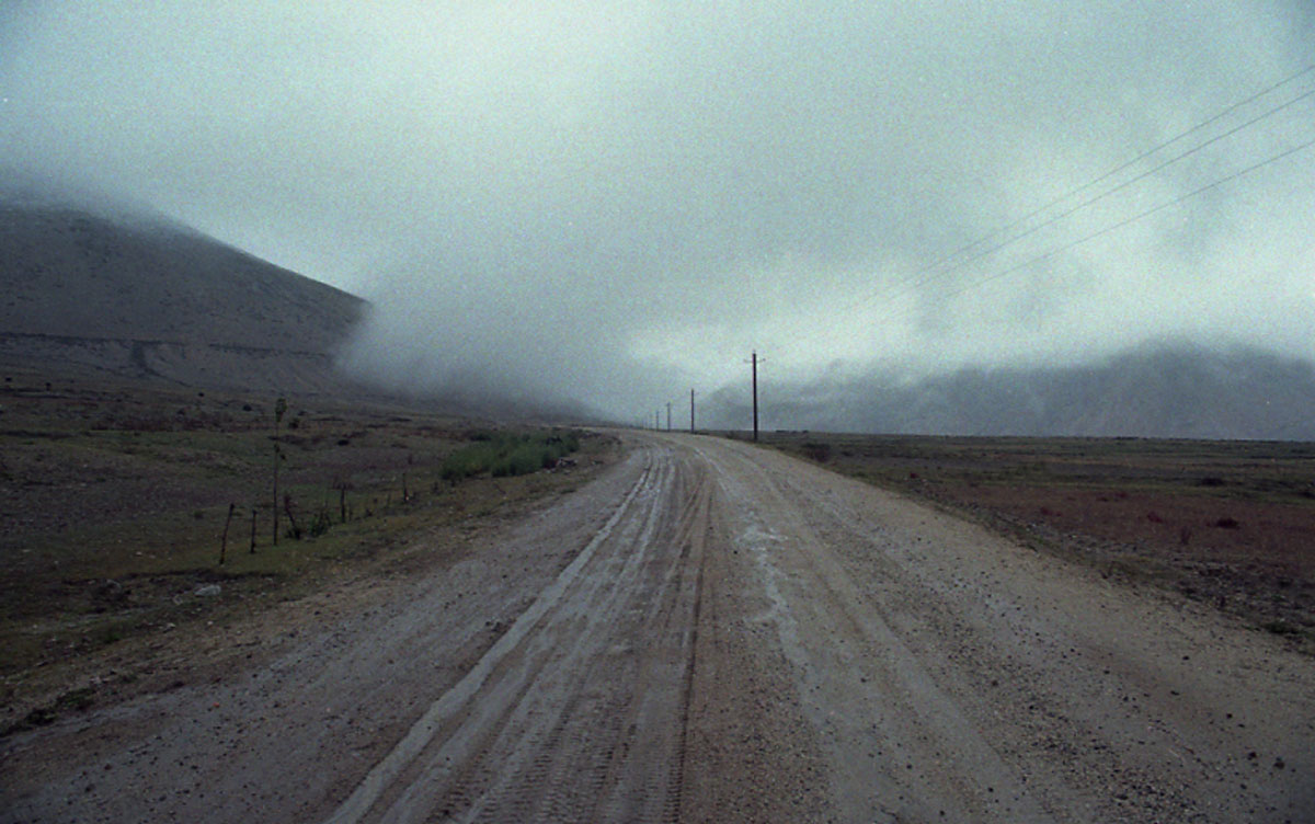
At Lamosangmu the road split. To the right the road continued towards Jiri, the last stop on the way to the Solo-Khumbu region and Mount Everest. The border post Kodari and Tibet was still a few kilometres ahead. The landscape changed as we left Lamosangmu, the road started climbing and the surface got worse. The hard surface had gone, the green rice paddies as well and the eroded forest had swept parts of the road away. Still wet after the monsoon rain, the road was almost unsurpassable in places. The bus driver asked his passengers to leave the bus and walk passed the poorest part to avoid an accident. As we later crossed the border and travelled on we had to change to Chinese registered vehicles. Two 4WDs and one bus carried the entourage further into Chinese territory.

The county capital of Nyalam is 30 kilometres from the border with Nepal. Only one road runs through the town, which is merely a cluster of a few stone houses and some travellers’ lodges. In one direction the road takes you to Kathmandu. The other direction heads towards Lhasa, the Tibetan capital, which is where I am going together with twenty other foreigners in the group. The only legal way to travel between the two cities was in a group. But Lhasa is still another 800 km away.


After breakfast, at 8:30 in the morning, we left in the mist of a rainy day. We were heading towards Lalung La, the first mountain pass on our way to Lhasa. At 5,050 meters, it meant ascending around 1,500 meters in an hour or two. After about 45 minutes the rain turned into sleet turned into snow, and the small settlements by the road changed colour to white. We saw women and children herding yaks, and some came running towards the caravan of jeeps that negotiated their way along a washboard like road across the plateau.
We reached Lalung La pass at 11:15 all covered in snow and mist. Not much to photograph. Snowing has stopped, but it was hard breathing, and even a short walk out to pee and take a picture made me gasp for breath, and it exhausted me. 


In good weather one should be able to see the famous Qomolongma from here. Or Sagarmatha. Or Mount Everest. Sir George Everest, who gave the name to the mountain, felt really honoured when Queen Victoria back in 1865 decided to name the tallest mountain in the world after him. Thirteen years earlier he had, as surveyor general in British India, found that the mountain stood 8,848 meters above sea level, and as such qualified to be the highest in the world. His successor thought that the mountain, then known as Peak XV, should have an English name, hence Mount Everest. It should, however, take another 88 years until man stood on top of the world. On May 23, 1953, Edmund Hillary and Sherpa Tenzing reached the peak. 


We arrived at the village of Thingri around 2 pm. The low clouds have disappeared, the sun was out and we could see the mountain range in the distance. Thingri is starting point for reaching the northern Everest Base Camp.


Monday, September 23: On the third day of my Tibetan journey I woke up while the full moon was still in the clear sky. Dawn had just broken and it seemed to be a beautiful morning. We had checked in at Happy Hotel in Lhatse shortly after sunset last night after having crossed the Lhakpa La [pass] at 5,220 meters. The temperature at the pass was around zero, with sleet, wind, and with hardly any visibility. That was too uncomfortable for spending much time and we also had to get to our destination before dark. From Nyalam to Lhatse the distance is 292 kilometres, and that had taken us about 12 hours–including breaks.
The Happy Hotel had very simple rooms surrounding a rather large yard in the middle, with two toilets located at the far end of the row. The toilets were, if possible, in an even worse condition than the one from yesterday’s hotel –just a hole in the floor, and with no light one had to tread carefully. I acquired a headache just before going to bed, but took a Paracetamol and slept soundly through the night. No problem with altitude sickness, even though we had climbed from a little over 3,000 meters to the pass of 5,220 meters.
After breakfast with bread, fried eggs, and green tea I went for a walk in this small town. There was not much to see, basically just one street (thru road) with white tiled houses on either side for about 200 meters. The tiles made the whole town look like a bathroom. The street was quiet, but somehow three musicians had spotted me, approached me and performed a song. I paid them one Yuan each in the hope they would be happy and leave.
We left shortly after nine, heading towards the second city of Xigatse. The average elevation in this extremely beautiful valley is around 4,000 meters, and barley is the main crop at this altitude. Around one kilometre out of town the tarred road turned into a dust road and with the passing trucks breathing was difficult. Also I could see nothing as they passed. We stopped for a photo in the valley, and kids popped up in less than a minute from seemingly nowhere to satisfy their curiosity or to hope for some baksheesh–unfortunately. They are all very dirty, don’t seem to clean their nose, wash their face nor clothes for weeks on end.

After another 30 minutes we reached the end of the valley, and we started climbing to another pass, Tsuo La pass at 4,500 meters, where we arrived at 10:15. This time we had a clear sky, but from this pass there was no high snow capped mountains to be seen.
We arrived Xigatse, the second biggest city in Tibet, around 2 pm, and I had lunch (sweet and sour pork) in the hotel restaurant for 35Y. The whole group then proceeded to see the Tashilumpo Monastery, the home of the Panchen Lama. The present Panchen Lama is a 10-year-old boy – a hoax installed by the Chinese. That was what the Tibetan guide told us in the bus before we went to buy the tickets at 45Y each. Photography outside was allowed free of charge, but inside the temples, only at 10Y a snap.
The Panchen Lama is the second highest-ranking lama after the Dalai Lama in the Gelugpa (Dge-lugs-pa) sect of Tibetan Buddhism (the sect which controlled Tibet from the 16th century until the Communist takeover). The successive Panchen lamas form a tulku reincarnation lineage, which are said to be the incarnations of Amitabha Buddha. The name, meaning "great scholar", is a Tibetan contraction of the Sanskrit pandita (scholar) and the Tibetan chenpo (great). Who is the true present (11th) incarnation of the Panchen Lama is a matter of controversy according to Wikipedia: the People's Republic of China asserts it is Qoigyijabu, while the Tibetan Government in Exile maintains it is Gedhun Choekyi Nyima, whom they allege to be missing since 1995.
Tibetan Buddhism is the body of religious Buddhist doctrine and institutions characteristic of Tibet, the Himalayan region (including northern Nepal, Bhutan, and Sikkim), Mongolia, Buryatia, Tuva and Kalmykia (Russia), and northeastern China (Manchuria: Heilongjiang, Jilin). It is a multifaceted and integrated teaching, naturally implementing methods for all human-condition levels: Hinayana, Mahayana, Vajrayana (Tantric Path) and Ati Yoga (Dzogchen). In the past, Tibetan Buddhism was referred to by some as "Lamaism", but this is now considered inappropriate.
I had a nice hot shower for 5 Y after coming back from the monastery. After three days of not being able to wash, that surely felt good. The Zhufengyouyi Binguan had one major block of rooms, and smaller and cheaper rooms in houses scattered around the yard. Today’s room accommodated only five, so I was pushed to share another room with a straight couple from Slovenia. Actually much better as there were only three in this room same size as the other. Besides they were busy with each other all night.
The group of six (which had shared room so far and consisted of two Germans, one Indian, one Japanese-French, one Nigerian, and me), arranged to meet for dinner at 8:30 pm., which meant I had a couple of hours to relax. The weather stayed nice all day in Xigatse. It was warm in the sun, a t-shirt was sufficient, but a sweater was good in the shade.
Xigatse being basically a Chinese city now, I had learnt the word fan dian (for restaurant) in case the taxi driver wouldn’t know any English. True enough, neither he nor his friend understood a single word, nor did they understand my feeble Chinese trying to explain we were hungry and needed something to eat.
The taxi set us back 12 Y, and after wandering about for an hour we finally found one Chinese noodle shop. No English menu, no English spoken. However, the Japanese guy with the French accent went back to kitchen and tried to explain we wanted chicken. The cook came up with freshly made, superbly tasting noodles and vegetables, a meal that came to 53Y for all six, including two beers. They had great fun, as three of the guys didn’t manage the chopsticks.

Tuesday, September 24: Today’s destination is Gyantse. The road to Gyantse is paved all the way, and there is no need to climb scary mountain passes. The 92 km took us about 2 1/2 hours including stops for photography. Before leaving Xigatse the guide took the whole entourage to the bank to change our travellers’ cheques and cash. Exchange rate was 8.19 to the US dollar. About 50 km from Xigatse we stopped in a village for a police check, with lots of villagers working in the fields, harvesting barley. About ten km from Gyantse we stopped for a flat tyre. And again, guess what? Kids turned up from seemingly nowhere.
We checked in at Wutse Hotel, again the same gang of six shared the room. The hotel had a better standard than the ones we had stayed in so far, with tiled floor and hot and cold water in the shower. It had Western style toilets, not like the typical Chinese where everything is open with no cubicles, where everybody squat next to each other. Last night at Xigatse, I got up before dawn and luckily had the shitting hall to myself. One hour later I would have to share the delight with a bunch of other travellers.
Just around the corner from our accommodation, the old city unfolded. At the end of the street were the Kumbum and the Pelkor Chode monasteries. The Kumbum was commissioned in 1440. It raises over four symmetrical floors plus two upper floors and is capped with a gold dome. At a little over 4,000 m, climbing stairs like to the sixth floor of the Khumbun very quickly gave me a short breath. Nearby the monastery was a typical Tibetan village with the herds living downstairs and the people living upstairs. The village was quiet, but as always the kids would appear from apparently nowhere.
In 1904 Gyantse was the scene of a major battle between Tibetans and British troops under Colonel Younghusband as the British advanced on Lhasa. Under orders from the Viceroy of India, Lord Curzon, Younghusband led a military mission to Tibet as a result of disputes over the Sikkim-Tibet border; the mission controversially became a de facto invasion and British forces occupied Lhasa. Gyantse was famous for its woollen carpets, which were considered among the finest in all of Tibet. From Gyantse an old trade route runs down to the Sikkimese capital of Gangtok, but the Chinese closed this road after their 1950 occupation. But Gyantse remains as a reminder to more glorious days and still has the feel of a frontier town, with horses and yaks on the main streets.


Wednesday, September 25: This was to be the last leg of our journey. Setting out in the morning we were scheduled to reach Lhasa in the late afternoon. In Lhasa the entourage would split up and we would have to find our own accommodation and settle our continuation of the journey. We would have to negotiate two mountain passes, travel along the Yamdrok Tsho lake and pass a big man made dam.
The 4WD left Gyantse at 8:20 in the morning, climbing steadily upwards along the dam that is situated at an altitude of 4,330 meters. Parts of the road provided a marvellous viewpoint of the dam and the stunning surrounding mountains. At around 10 o’clock we arrived in the village of Long Mar, a small village with parabolic antennas and solar power. There was some kind of a market place weighing rice and with an old man taking notes in a book.

The weather in the mountains can change very rapidly, from clear sunny skies to dark skies with rain and snow. This Wednesday was mostly cloudy all the time, and with low temperatures hovering around zero as we reached the first mountain pass–Karo La at 5,010 metres. This pass was full of Tibetans who had learned the art of making bucks from tourists. For five Yuan a snap, you could be photographed together with a Tibetan and his yak. I was surprised to see that people actually were living at this altitude, as stone houses were scattered all around the area.
After having a buffet lunch for 20 Yuan at the village of Naparse, the jeep would take us along the lake. It is one of Tibet’s largest lakes, and on a clear day the beautiful deep blue-green colour would emerge. On a grey, misty day like today, the beauty wasn’t there, and the road along the lake was actually several hundred meters up in the hillside with no protection on the side. It was indeed nerve racking and the German woman in the party was quiet scared and her husband asked the driver to slow down. At the last mountain pass, around a 100 kilometeres from Lhasa, we again had the opportunity to be photographed sitting on a yak for five Yuan a snap. At the top you had a view of a very misty valley on the southern side, and a clearer valley with Lhasa in the distance on the northern side.


At the bottom of the mountain we would pass the Brahmaputra river, or Tsangpo as it is called here, and a 70 km paved road with big advertising boards and lined with juniper trees would take us to the Tibetan capital. After five days on mainly dusty roads Lhasa seemed like an oasis.