Our Greek Odysseus

The Peloponnese peninsula is a less visited area of Greece than the Cyclades and other islands. It is nevertheless just as a rewarding destination as the more popular island hopping, and even more so because of less congestions of tourists.

After spending the first night in Rafina on the east coast after arriving at Athens airport, our journey around the peninsula started at the famous Corinth Canal.  It cuts through the narrow Isthmus of Corinth and separates the Peloponnese from the Greek mainland, technically making the peninsula an island. It was constructed between 1881 and 1893, cut 79 metres through the rocks down to sea level, only 21 metres wide at the bottom and 6,343 metres long. Apart from still being used today, it is also a tourist attraction.  

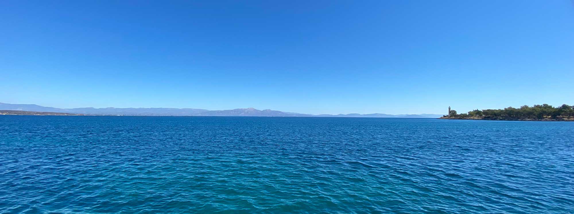
Following the main road south we stopped for lunch around 3 pm in a village called Loutra Eleni, in a taverna right by the sea. The sun shines on the crystal-clear water, but as it is out of season no one is in the sea. It’s a pleasant 27 degrees as we’re enjoying our tzatziki, aubergine spread, and garlic bread. Apart from being tasty, as Greek food always is, it comes in large portions at a very sympathetic price.  

Hotel Avaton is at the junction where the road to the Temple of Asklepios of Epidaurus starts. 306 metres above sea level in a grand but lonely and deserted landscape, making you feel as if you’re in the middle of nowhere. For 45 Euros we get three beds, a bathroom with a window and breakfast in the morning. Luckily there’s a taverna across the road where the usual Greek fare filled our stomachs on demand.

Greek breakfasts are hardly anything to fill your stomach, but we were up early to reach the UNESCO site of Epidaurus, only a kilometre away. No entry without vaccination certificate, face mask mandatory inside the museum, and a 12 Euros entry for ordinary people and half price for EU citizens above 65 with ID to prove your age. A wrinkled face won’t suffice.

The Ancient Theatre (c. 340-330 B.C.) is a renowned monument included in UNESCO’s World Heritage Sitelist as part of the Sanctuary of Asclepius, the god of medicine for the ancient Greeks. The dramatic performances staged in this theatre were watched by the god’s patients, during their stay at the healing centre. 

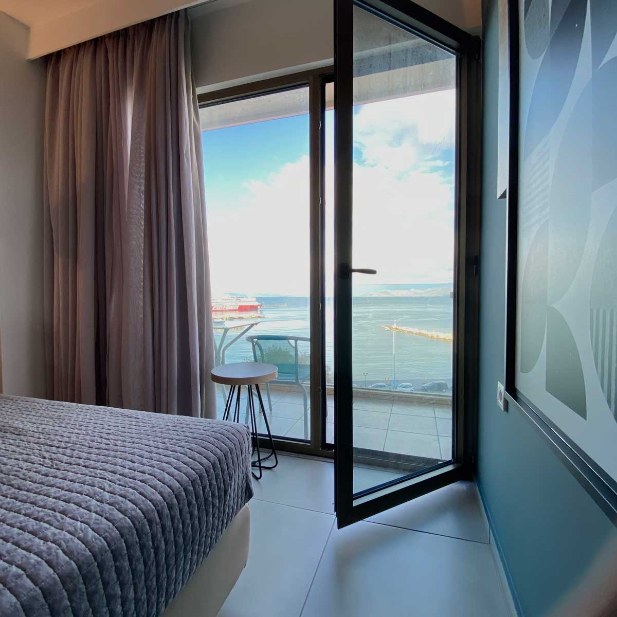
Next on the agenda was Nafplio, the first capital of modern Greece for a brief period after the end of the Ottoman Empire in 1822. Its main attraction today is the Palamidi Castle, nestled on the crest of a 216-metres high hill and built by the Venetians during their second occupation of the area. With 999 steps from downtown of Nafplio you can climb up to the top, or you can do as we did, go by a ten-euro taxi ride to the castle entrance, and then walk down the stairs to the old town, where our hotel is located with a view of the harbour.

Arriving at the top, stunning panoramic views awaits you, but only after you’ve shown your EU vaccine certificate and paid your 8 Euros entrance fee or, as in my case, only half because of my age.  All restaurants also require EU vaccine certificate for sitting inside. No entry without. Pedalio Taverna along Odos 25is Martiou in Nafplio is also one of them. A popular eating place for locals according to Lonely Planet, but from our observation two consecutive nights it was filled with plenty of people who spoke another language than Greek. All along, this street is filled with traditional Greek tavernas. It’s outside the old town area and not along the seaside, so it’s also free from young men hassling you to eat in their restaurant.

We got off the next morning with a cloudy sky, but still an agreeable temperature. Our first destination was only a ten-minute drive north of the town.  

Tiryns was a hill fort with occupation ranging back seven thousand years, from before the beginning of the Bronze Age. It reached its height between 1400 and 1200 BC, when it was one of the most important centres of the Mycenaean world, according to Wikipedia and the tourist brochure handed out when buying the entrance ticket. For the uninterested eye it may look like a pile of rocks, but the site earned UNESCO World Heritage recognition in 1999 for the purpose of protecting the remains for the benefit of all humanity. A major earthquake and an ensuing fire completely destroyed the site in the late 13th century BC.  

Next on the sightseeing list was the Archaeological Museum in Argos, that unfortunately was temporarily closed due to an EU 5 million grant for refurbishment. This visit was supposed to educate us on the history of the region.  

On top of the hill at 275 metres is the medieval Larissa Castle with a stunning view overlooking the town. Argos is, again according to Wikipedia, one of the oldest continuously inhabited cities in the world, and the oldest in Europe.  

Continuing further south we stopped in the seaside village of Kiveri for lunch. Grilled chicken and Greek salad for two came to twelve euros and fifty cents. Not too bad. Population 1,000. Destination for tonight is Leonidio (population 3,826) a quaint little town with extremely narrow streets set in a gorge with a spectacular landscape, bound by two abrupt mountainsides enclosing the town from the north and south. The river Dafnon passes through the town, and its banks are linked with three bridges. The road to Leonidio is winding its way ascending and descending along the seaside. Arriving close to 7 pm, we’re settling in at Leonidio Rocks with room at 35 euro, a balcony with a view and free parking in the garage underneath.

Monemvasia is a small town located on a small island off the coast and linked to the mainland by a 200 metres causeway. Once an important trade and maritime centre, the town is characterised by its fortified walls and narrow cobblestone streets, and surprise: cars are banned. The island itself looks like a rock and is also nicknamed Gibraltar of the east by some. The town and fortress were founded in 583 AD by inhabitants of the mainland seeking refuge from constant foreign invasions. On top of the rock is a large plateau some 100 metres above sea level, up to 300 m wide and 1 km long, the site of a once powerful medieval fortress. The town walls and many Byzantine churches remain from the medieval period. 

Today the town survives largely by tourism as so many other places in Greece. Most of the medieval buildings have been restored, and many of them converted to hotels. 

The 100 kilometres that separates Monemvasia from Leonidio took us close to five hours including a stop at Kosmas, a charming mountain village at 1,165 metres above sea level. Population 362. Before arriving at the picturesque village, we had to climb up on a long hairpin road with lots of German caravan tourists. Lunch in a small village called Agios Dimitrios Zarakos. Greek music, men playing card and smoking cigarettes. Chicken souvlaki and tzatziki at Taverna Mayros. At Monemvasia by the sea we checked in to a spacious room with a balcony and a bay view at only 35 Euros a night, including a fast Wi-Fi (a rarity these days).  

The island of Monemvasia was separated from the mainland by an earthquake in the year 375 AD.  On top of the 100-metre-tall rock is the Agia Sophia Church, reached after a 20-minute climb. This climbing was more Sherpa style than the one in Nafplio. The foursquare Byzantine church was built in the 12th century, and its interior is richly decorated with wall paintings. It was converted into a mosque during the Turkish occupation. Written sources indicate that it was dedicated to the Virgin Mary Odigitria of Mysteas. It is considered a copy of Hagia Sophia in Constantinople for this reason, and after the revolution of 1821 it was dedicated to the Wisdom of God. The resemblance is merely the name and the dome in my opinion. Built on cliff with an astonishing view of the sea.  

A walk through the labyrinth of cobblestoned streets in the walled town below the towering castle takes us back into history, if you can overlook the touristy souvenir shops and cafes targeting the hordes of tourists that come here every year for a bit of romantic adventure. Apparently, the regular population is down to 40 inhabitants, most people working here commute the one-kilometre distance to the mainland village of Gefira.  

After hiking up and down again on the rocky island for three hours it was time for lunch in the shady side of a sunny terrace, settling down for a Greek salat with locally produced Feta cheese accompanied by the sound of the waves and Secret Garden softly played over the loudspeaker. And a pleasant temperature of 24 degrees.

Our car trip around this part of Greece is slowly progressing from one small village to another. When leaving in the morning we are not quite sure where we will end up. Just before sunset we finally arrived at Porto Kagio, a peaceful village by a bay at the southern end of the Mani peninsula. Just another (mountainous) peninsula on the Peloponnese peninsula. The road leading down to the tiny village is a steep and narrow hairpin road from the mountain plateau 400 metres above. Porto Kagio’s main economy is tourism, despite only having 35 hotel rooms all together. 

But before ending up here after driving endlessly on narrow and winding roads along the east coast of the Mani peninsula, we spotted the famous Dimitrios shipwreck. Just north of Gytheio, a tourist town in the Kolpos bay, right on the beach lies a rusty cargo ship of 965 tons originally bult in Denmark in 1950 and named Klintholm. Now a tourist attraction and a playground for kids, swimming, and diving in and around the wreck. 

There are many rumours about the ship′s origins and how it got stranded on the beach. Most relate to that the ship was used to smuggle cigarettes, then seized by the port authorities and then deliberately released from the port and left to be dragged by the sea and then ended up on the beach. And it is still there. 

Further down south we lunched at Polytimi Taverna in the village of Kokkola, a very quiet and drowsy town. The balcony had a splendid view of the sea, and we could look down to the narrow streets that are dead at this siesta time, but with the occasional widow dressed in black venturing out to sweep the front of the building.  

Lonely Planet says Vathia Kastropolitea is the most photographed village in the Mani peninsula. But the village is in fact, apart from two dwellings, totally abandoned and in neglect and decaying. If there is such a thing as life in an abandoned village, the following photographs are the documentation of that.  

Lunch at the only place for miles, off the main road down by the sea in Chalikia Parelis, a tiny village by the sea. On the menu was Greek salad, fried potatoes, and small fish.

Areopoli is a small town (population 1,014) on a plateau 250 metres above sea level. Just a few kilometres away is a steep hairpin road down to Limeni, another hamlet by the sea. Here we’re surrounded by mountains to the east, and the sky has changed from clear blue to a threatening black, although forecast says no rain. Around the town square and the adjoining streets there are dozen tavernas serving typical Greek fare, quite a lot for such a small town. At night it comes alive when bars and tavernas open in the narrow cobblestoned streets.  

The name of the town means "city of Ares”, the ancient Greek god of war. The Greek war of independence was started at Areopoli in 1821 by Petros Pierrakos, the last Ottoman governor of Mani, the district. Aptly there is a huge statue of him in the town square.  

We left Areopoli in the morning passing through one tiny village after the other. First there was the picturesque Limeni, a stone housed village normally full of tourists, then there was Oitylo, Nikon, Thalames, Pigi, Langada, Nomitsi, Kambinari, Platsa, and Stoupa before arriving at the ancient town of Kardamili. Homer cites In the Illiad Kardamili as one of the seven cities offered by Agamemnon to Achilles as a condition to re-join the fight during the Trojan War. The ashes of the British writer Bruce Chatwin, who died of AIDS in 1989, were scattered near a Byzantine chapel above the village the same year.  

The villages along the way were mostly deserted, but not abandoned, with the occasional octogenarian sitting at the village square café sipping his coffee. As usual the road was winding its way up and down with many of the villages lying at 500 metres, with garden of olive trees lasting all the way down to the deep blue sea.  

We managed an outdoor dinner in Kalamata before the predicted rain started late last night. The Greeks eat late, when we arrived at our chosen eatery around 8 pm, almost all tables were available, but by the time the dessert arrived they had to set up more tables and chairs. And just as we paid the bill, the raindrops kept falling and we paid a visit to the nearby umbrella shop. Kalamata is a lively city (population about 70,000), but first and foremost famous for its high-quality olives and of course it’s olive oil.

Forecast is grey skies for the next few days. Although a few drops fell as we left Kalamata this morning, the scattered clouds and occasional showers didn’t bother us much. In fact, as went along the clouds vanished into thin air and it was all blue again.  

Every town seems to have its own castle, and of course all of them have their own chapels and churches. Some are open to the public to see. So does Korini (population 1,409) at the tip of the western part of the Peloponnese. Also, a popular holiday destination.  

The town is nestled on a hill below a Venetian castle and reaches to the edge of the gulf. The town was founded in ancient times. The 2nd century Greek geographer Pausanias in his book Messeniaka reports the original location of Koroni at modern Petaldi, a town a few kilometres north of Koroni. He also reports many temples of Greek gods and a copper statue of Zeus.  

Methoni is another ancient town with a kastro, just 45 minutes further west from Koroni. The main economy today is tourism, thanks to its fine beaches and interesting castle. In October it’s quiet and peaceful and a perfect place to stop for a moussaka. The kastro dates back to the period after 1500 and the tower by the sea has been used in various instances as a prison. The kastro occupies the whole area of the cape and the southwestern coast to the small islet that has also been fortified with an octagonal tower and is protected by the sea on its three sides. Entrance is three euros.  

The next morning, we left Pyros at 10 am heading straight to Sparta. From Kalamata we took the mountain road that brought us up to 1,281 metres. Although shorter in distance, it’s longer driving than on the motorway even though that is 44 kilometres longer. We stopped for a coffee at Agios Vasileios, a mountain café halfway to Mystras after all the twisting and turning and up and downs. Because of the break and the slow driving, and that Mystras closes gates at 3 pm we decided to go straight to Sparta and do the UNESCO site tomorrow.  

We arrived Sparta in the afternoon and checked in to the neo-classical Hotel Menelaion — in a room that was anything but spartan. Modern day Sparta lies at the site of ancient Sparta, one of the most powerful states during the times of the Persian War.  

Modern Sparta's origins date back to the early 19th century when King Otto issued a decree on the construction of the new city. Bavarian city planners designed a city based on neo-classical architecture. Today Sparta maintains its good design, boasting large squares and wide streets lined with trees, while many of the older buildings remain in excellent condition, writes Wikipedia. Maybe it’s so.  

Taverna Tsipiuradiko To 50’s, up an alley from the main square and into the backyard, an atmospheric old style taverna with a spartan decoration (if any) and where they play soft Greek folk music. Around 8:30 pm the place starts filling up and seems to attract a wide range of customers. All dishes are under ten euros.  

On day 14 we’re coming to an end of our Greek odyssey. Today was our last day of sightseeing before returning to Athens and the airport. And as yesterday, the forecasted rain and thunder vanished into a clear blue sky as we approached midday. It was time to visit the archaeological site of Ancient Corinth. As in all other places: vaccination and face mask mandatory.

The ancient city of Corinth was a city-state which saw its hay days between 900 and 146 BC, one of the largest and most important cities of Greece, and with an estimated population of 90,000 at its highest. The archaeological site a few kilometres outside of present-day Corinth bear witness to a powerful state, but nevertheless collapsed more than two thousand years ago, when it was captured and razed by the Romans.  

The city had two main ports: to the west on the Corinthian Gulf which connected the city to its western colonies, while to the east on the Saronic Gulf served ships coming from Athens, Ionia, Cyprus, and the Levant. Both ports had docks for the city's large navy. Also, according to the museum on the site, few cities appreciated art and the artists as much as Corinth did.

[October 2021]